Natural features and shapes present on the earth’s surface are called landforms. The major types of landforms are mountains, hills, plateaus and plains. Buttes, canyons, valleys, and basins are examples for minor landforms.
Landforms like mountains and hills are formed as a result of the tectonic plate movements of the earth. Erosion by water and wind can create landforms like valleys and canyons. All these processes happen over a very long period of time (might take millions of years).
For example, it took 6 million years for the Colorado River to carve out the Grand Canyon in the U.S. state of Arizona. The highest landform on Earth is Mount Everest in Nepal. Located 29,035 ft above sea level (8,850 meters), it is part of the Himalayan range which runs across several Asian countries.
Landforms can exist underwater as well. The deepest landform on Earth is located in the South Pacific – the Mariana Trench.
Types of Landforms
Mountains: Mountains are much higher than the hills, they have pointed tops (peaks). There are several mountains inside the ocean as well. They are formed as a result of natural forces like volcanic eruptions, erosions and uplifts in the earth’s crust. Geologists state that forces of heat and pressure within the earth’s crust are responsible for such natural forces. Inshort, it can be said that tectonic movements of the earth’s plates trigger such geological activities. Mount Fuji in Japan and Mount Erebus in Antarctica are examples of volcanic mountains.
Valleys: A valley is an elongated low area running between hills or mountains. Rivers are responsible for creating valleys. Valleys tend to be very fertile and are really good for farming. The sides of valleys are called valley slopes. A flood plain is the section of floor along the river bank. Canyons are very narrow and deep valleys.
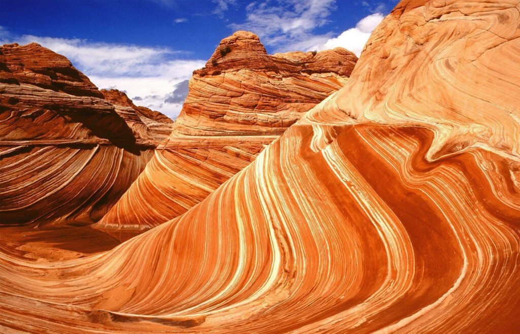
Plateaus: A plateau is an elevated landform which rises above the surrounding area. They constitute 45 percent of the entire earth’s land surface. The Columbia plateau of the United States and Deccan plateau of India are fairly flat land surfaces. They were formed as a result of lava flows spreading over thousands of square kilometers. Owing to their elevated positions, plateaus are subject to erosion. While low plateaus are good for farming, high plateaus are suitable for grazing livestock. Other examples of plateaus are the Bolivian plateau in South America, the plateaus of Iran, Arabia, and Anatolia.
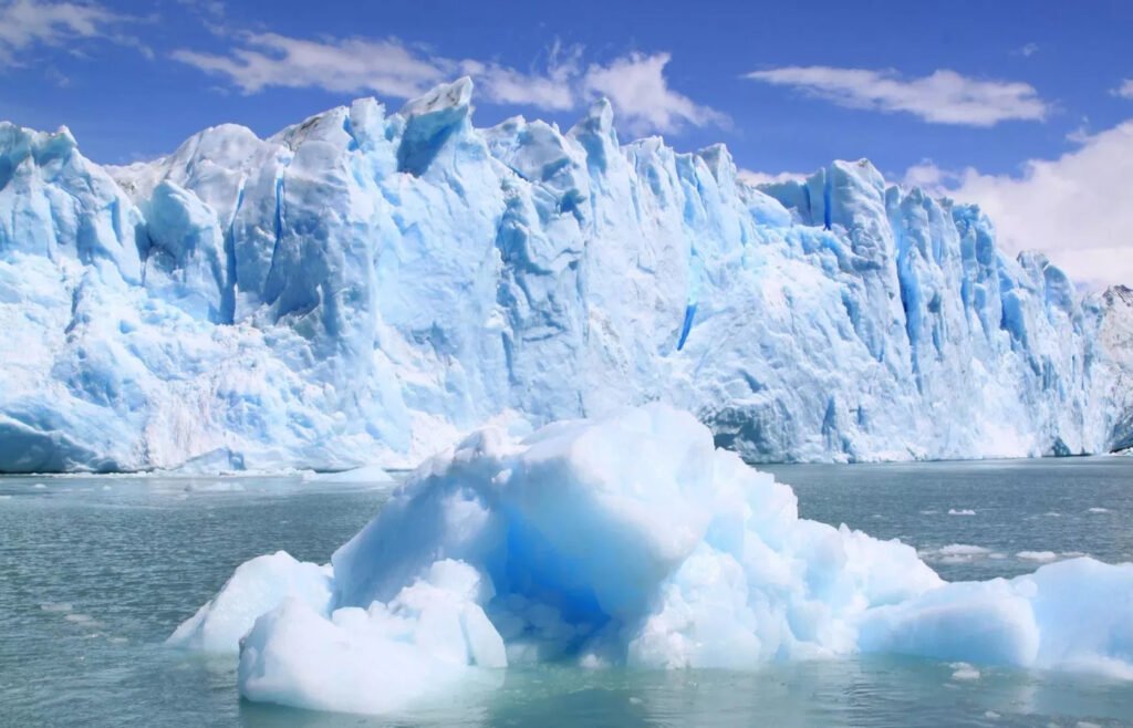
Glaciers: Perennial ice sheets on the planet are called glaciers. Glaciers are huge masses of ice which slowly move over land surface. They are mostly found in the high mountains and the cold polar regions. Very low temperatures in such regions facilitates buildup of snow and densification into ice. According to calculations, 75 percent of the world’s fresh water exists in the form of frozen reservoirs. The Greenland Ice Sheet and the Antarctic Ice Sheet are among the prominent glaciers in the world. Global warming has resulted in melting of glaciers across the globe. This leads to rising sea levels, which in turn increases coastal erosion and elevates storm surge.
Hills: They are not as high as mountains. Hills are either created by the accumulation of rock debris or deposition of sand by wind and glaciers. They are mostly found in low mountain valleys and plains. In some cases, lava cools and hardens in a pile post volcanic eruptions, forming a hill. Nainital, Mussoorie, Ooty, Coorg and Lonavala are few of the major hill stations in India.
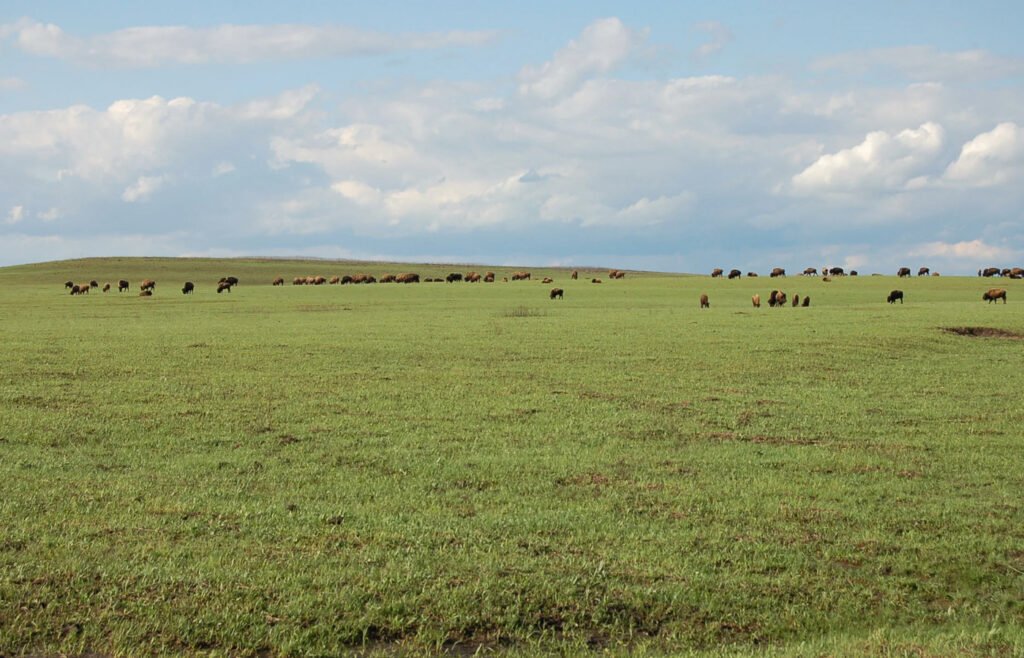
Plains: Broad flat areas on earth’s surface spreading over a wide area are called plains. It can be found both inland and along the coast. The Atlantic coastal plain is among the most populated and fertile coastal plains in the world. Inland plains are mostly located at high altitudes. Thick forests grow on plains in humid climates. Plains are mostly covered by grasslands. Humans prefer settling on plains. The soil and terrain are good for farming and building settlements. A floodplain is created as a result of continuos accumulation of sand, silt, and mud when a river overflows its banks.
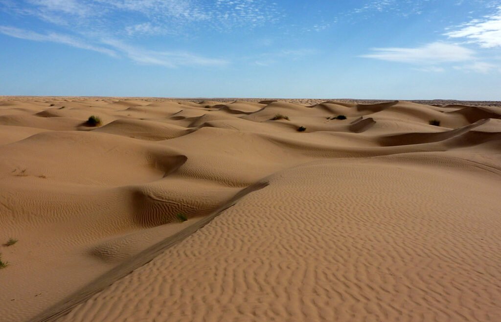
Deserts: The hot and dry areas of the world are called deserts. They are mostly arid or semi-arid lands with little or no vegetation. With little or no rainfall at all, deserts constitute 20 percent of earth’s total land cover. The four major types of deserts are semi-arid deserts, hot and dry deserts, cold deserts, and the coastal deserts. Plants such as cacti and short shrubs are mostly found in deserts. These plants can conserve water and tolerate high temperatures. Snakes, lizards, and birds are capable of surviving in deserts. The Sahara of North Africa, Kalahari desert and the Thar desert in India are a few major examples.
In this article, we have discussed the various types of landforms in detail.